OpenRivers Programme
grants for removal small barriers in Europe

42 Mio Euros for river restoration
One million structures fragment Europe’s rivers, contributing to declining biodiversity and water quality. The AMBER EU project has shown that small structures of up to 2m represent 68% of the structures in Europe, and that their removal is more effective from an environmental point of view and better accepted by the population than the removal of larger structures.
The Arcadia Foundation**, by relying on the AMBER EU study, created the Open Rivers programme* in October 2021, which will finance a number of small-scale dam removal projects in Europe to the tune of 42 million euros until 2026/2027.
* The European Open Rivers Programme is a Dutch grant giving foundation funded by Arcadia. The foundation aims to restore endangered European rivers by supporting interventions that lead to the removal of small dams and the restoration of river flow and biodiversity.
** Arcadia is a charitable foundation that works to protect nature, preserve cultural heritage and promote open access to knowledge. Since 2002, Arcadia has awarded more than $1 billion to organisations around the world.
ERN can support and advise if you wish to apply
Dam Removal Europe, co-founded by ERN, is partner of the OpenRivers programme. As such, ERN is the interface for France and is ready to support or advise if you wish to apply. Contact : corinne.ronot (at) rivernet.org
The funding will be allocated in priority to clearing works but also to accompanying actions (studies…). The structures eligible for funding are of general interest. The criteria and procedure for applying are presented on the openrivers.eu website, as well as the guide for applicants and the application platform.
The main selection criteria are :
– height of the obstacle max 2m (this criterion may change during the year)
– the removal works will be completed after one year;
– significant ecological gains and local managers approving the project.
The criteria and procedure for applying are presented on the openrivers.eu website, as well as the guide for applicants category A and the application platform.
Projects managed by ERN, grants obtained for a total amount of 370,000 Euros.
Reopening of a long stretch of waterway, multiple deletions, priority Grenelle structures, biodiversity and heritage species issues, local commitment and short implementation times were the key factors in their selection. Focus on the projects managed by ERN! Financing obtained totalling €370,000.
La Tardoire (Haute Vienne - 87)
Located in the Charente catchment area, the Tardoire is a major concern for the European eel.
The restoration programme involves the removal of 4 structures. Their removal will free up 18.6 km of watercourse and reconnect 3.2 km of the river with its tributary, the Colle.
The restoration aims to improve the morphology and natural functions of the Tardoire. As a result, the quality of the aquatic habitats, which will be more diversified and better oxygenated, and the quality of the water will be enhanced, as will the hydromorphological functioning of the river.
Target species: Brown trout (Salmo Trutta), European eel (Anguilla Anguilla)
Project by Syndicat Tardoire amont SYMBA in partnership with ERN
Plus d’infos : http://syndicat-bandiat-tardoire.fr/
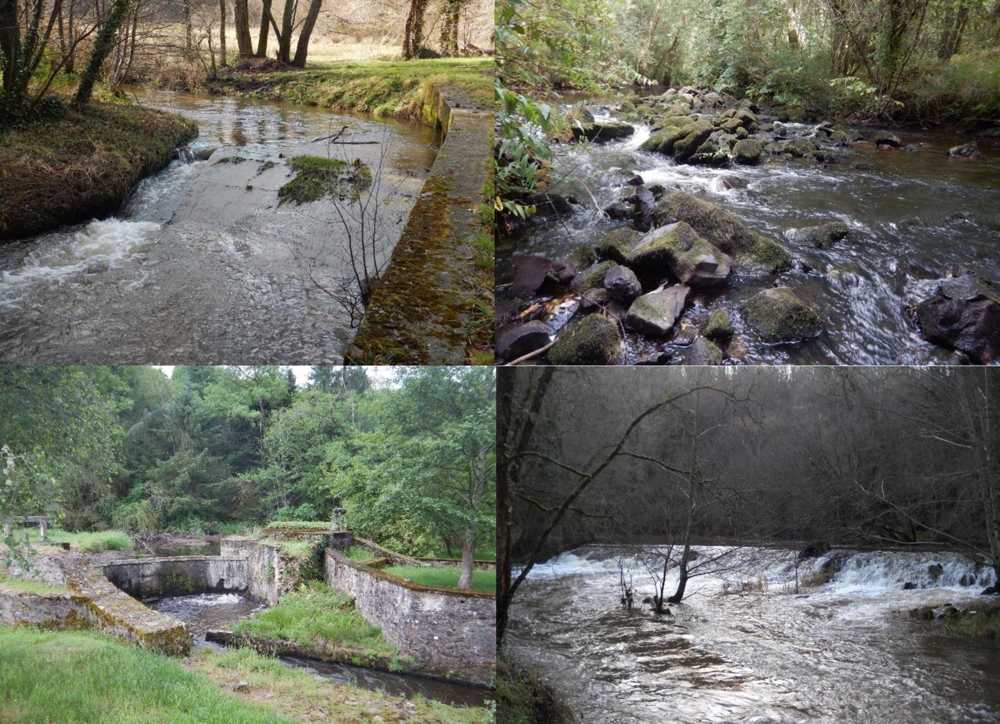
© SYMBA
Les Planches site (top left): works in December 2022, more infos
Raux site (bottom right): works in February 2023, more infos
Forges du Buisson site (bottom left): works in May-June 2023, more infos
Peyrassoulat site (top right): works in June 2023, more infos
More information on the project and the Tardoire: see our dedidated page
La Laussonne (Haute Loire - 43)
La Laussonne est un affluent de la Loire amont.
Refuge pour la biodiversité, l’accès aux tête de bassin est primordial pour la survie des espèces sensibles aux réchauffement des eaux dans le contexte de changement climatique. L’étude Explore 2070 précise d’ailleurs que certaines espèces d’eau fraiche, comme la truite fario, l’ombre commun ne pourraient survivre que dans ces zones d’ici 2050.
L’ouvrage à effacer est situé à environ 150 m de la confluence, les travaux permettront de reconnecter 44 km de rivières à la Loire. Le programme de restauration de la Laussonne prévoit également la suppression de deux autres ouvrages plus en amont, la restauration des zones humides.
Compte tenu du contexte local péri-urbain, les travaux incluent la restauration des berges avec des techniques de bio-ingénierie et de la végétation locale dans le but de stabiliser, améliorer les fonctionnalités des berges et bénéficier à la biodiversité.
Espèces cibles : Ombre commun (Thymallus thymallus), Truite fario (Salmo trutta)
Site Natura 2000 : FR 8301081, ouvrage grenelle
Maître d’ouvrage EPAGE Loire -Lignon
plus d’infos : www.epageloirelignon.fr
La Ressegue (Cantal - 15)
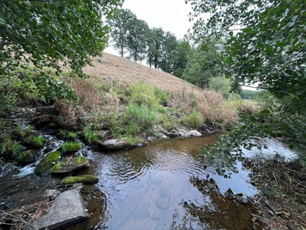
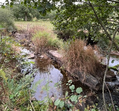
La Ressegue est un sous-affluent de la Cère. La Moule perlière d’eau, inscrite sur la liste rouge de l’UICN (EN- En danger pour la France) est présente sur ce bassin.
Les travaux de restauration permettront de reconnecter 12.3km soit 96% du linéaire de la Ressegue et 23 km de cours d’eau sur tout le bassin versant. La granulométrie, la qualité de l’eau, les habitats favorables à la truite fario et à son hôte la moule et l’aire de répartition de ces espèces en seront améliorés tout comme le fonctionnement hydromorphologique de la rivière.
Espèces cibles : Truite fario (Salmo trutta),Moule perlière d’eau douce (Margaritifera margaritifera), Loutre d’Europe (Lutra lutra)
Site Natura 2000 : FR8302033 – Affluents of the Cère in Chataigneraie.
Maître d’ouvrage : Syndicat Mixte de la Dordogne Moyenne et de la Cère Aval
Plus d’infos : https://www.smdmca.fr/
La Souvigne (Correze - 19)
La Souvigne est un affluent important de la Dordogne pour la reproduction des salmonidés. Elle abrite 8.4% des zones de frayères du bassin de la Dordogne (selon une étude ECOGEA pour MiGADO, 2018). Une attention particulière doit être portée à la restauration de cet affluent pour les poissons migrateurs.
Le programme de restauration sur ce bassin, 7 obstacles à enlever, permettra de reconnecter 15km soit 83% du linéaire de la Ressegue et 25 km de cours d’eau sur tout le bassin versant. La granulométrie, la qualité de l’eau, les habitats favorables à la reproduction et l’accès aux frayères en amont en seront améliorés tout comme le fonctionnement hydromorphologique global de la rivière.
Espèces cibles : Truite fario (Salmo trutta), Saumon Atlantique (Salmo salar), Anguille Européenne (Anguilla anguilla).
Bassin de la Dordogne classé réserve de Biosphère UNESCO depuis 2012.
Maître d’ouvrage : Syndicat Mixte de la Dordogne Moyenne et de la Cère Aval
Plus d’infos : https://www.smdmca.fr/
The Branugues (Cantal - 15)
The Batitan dam is located on the Branugues stream, considered a nursery for salmonid reproduction. This stream is the last potentially accessible upstream tributary in the Cère basin before the 15-meter-high Nepès hydroelectric dam on the Cère. For many years, the fishing federation has been protecting and restoring the hydromorphology of the watercourse, but fish are unable to access the main part of this tributary because the Batitan mill blocks the passage of fish 800m after the confluence with the Cère.
The removal will open up more than 8 linear kilometers of waterway and reduce the pressure currently observed on the Cère at Laroquebrou. This will make 87% of the Branugues stream accessible and fully open. Also this will improve grain size, water quality, breeding habitats and access to upstream spawning grounds, as well as the overall hydromorphological functioning of the river. Removing this dam improve the hydromorphology of the sector by eliminate the clogging of the riverbed by the fine sediments stored on site by the dam.
Focal Species : Brown Trout, Brook Lamprey
Key habitats : Rivers, riverbanks, wet meadows, ash and alder woods in fast-flowing rivers, streams, trout areas
Classified site Natura 2000
Km to be opened: 8 linear kilometres
Commune Laroquebrou, Département du Cantal, Région Auvergne Rhône Alpes
Project by Syndicat Mixte de la Dordogne Moyenne et de la Cère Aval
Partners : Fédération de pêche du Cantal, ERN, Open Rivers
More infos : https://www.smdmca.fr/
The Eyrieux (Ardèche - 07)
The Eyrieux valley is a land of contrasts, from its source at an altitude of 1,105 m to its confluence with the Rhône River at 93 m, south of Valence.
The upstream Eyrieux is typical of a good-quality salmon-farming zone, with brown trout being the target species. The white-footed crayfish (Austropotamobius pallipes) has also been invotoried in the vicinity of the project, and the Eyrieux basin is one of the most heavily populated in France to date, with over 100 km of its length occupied. Other heritage species include the yellow-bellied sounder, wetland azure, alpine newt, otter and fine-bodied corduridae.
Two weirs, around 100 m apart, block the upstream Eyrieux in the commune of Saint Agrève. They were created to supply “textile” activities, a mill and a sawmill, but today, these two water intakes are no longer used for any purpose
The work will consist of removing the 2 weirs and recreating the 70 m linear stretch of the Eyrieux in its natural position at the bottom of the valley, on the section that had been diverted. This will contribute to the full restoration of the aquatic environment in this sector of the upstream Eyrieux. In particular, they will enable the renaturation of the river’s morphology, habitats and surroundings (riparian vegetation, open spaces, etc.).
Fish continuity will be fully restored along 15 km of the upstream Eyrieux, reconnecting it with 4 of its tributaries (18 km), for a total of 33 km of reopened main watercourses and 12.5 km of secondary streams.
Focal species : Fario trout, White-footed crayfish
Key habitats : riparian forest, ash alder grove, rivers, riverbanks, ash and alder woods, salmonidae areas
Km to be reopened : 33 linear kilometres, all stream
Commune de Saint Agrève, Département de l’Ardèche, Région Auvergne Rhône Alpes
Project by Syndicat Mixte Eyrieux Clair
Partners : Fédération de pêche de l’Ardèche, DDT07, OFB, Commune de Saint Agève, Commmunauté de Commune Val d’Eyrieux, ERN, AERMC, Open Rivers
More infos : https://www.eyrieux-clair.fr
News
!! Next calls for application
October 29 (A, B)
Projects carried out, supported by ERN, with funding from the Open Rivers programme
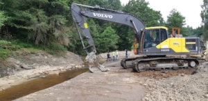
Removal of 4 weirs on the Tardoire, Charente catchment (Haute-Vienne) 2022-2023
The movie about the project (13min)
Le programme Open Rivers est soutenu par la fondation


 ERN is the official WWF Freshwater Partner in France and cooperates with WWF Switzerland, Austria, Netherlands and others