The Chamuera, Swiss river


The Chamuera is a river in the extreme south-east of Switzerland, Graubünden Canton, Engadin area (Map below).
It is the second main tributary of the Inn River on the right bank.
The confluence is located in the Municipality of La Punt-Chamues-ch between St Moritz and Zernez
Its total length is 15 kms and its catchment area is 73.7 km2.
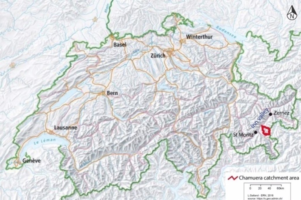
Location of the Chamuera catchment in Switzerland
The last kilometre of the Chamuera River flowsstraightthrough the village of La Punta and itsbanks are 100% artificialised with rocks and concrete.
1.37 kms from the mouth, there is a flow data station which is an obstacle for fish migration.
Because of these heavy alterations on the lower part, the selected section (green color on map below) is limited to a section of the Chamuera River from the spring down to the flow datastation (Map below).
This section is 13.75 kms, so 91% of the total length.
And its catchment area is 73.4 km2, representing 99.6% of the total catchment area.
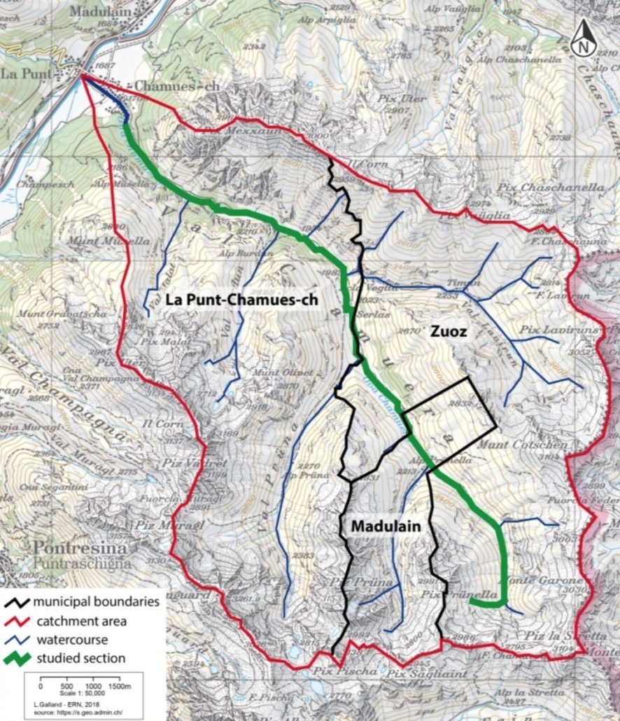
Section studied of the Chamuera River