The Ammer river in Deutschland
The Ammer is a river in southern Bavaria, Germany.
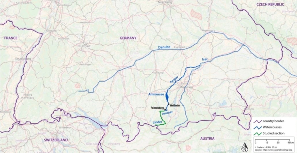
It’s actually 3 rivers in one and changes its name twice (Figure 30).
- The upper part, flowing to the east, is called the Linder, from the source at the Austrian boundary to Graswang, where it disappears underground (karstic losses).
- Then from the new emergence (resurgence) to the Ammersee lake, it’s called the Ammer, flowing to the north.
- And the lower part is called the Amper, flowing north-eastward, from Ammersee to the Isar river, which is a right tributary of the Danube.
>> The total length of the Linder/Ammer/Amper is 198 kms.
Linder/Ammer River has only one hydropower plant, which is exceptional in southern Bavaria and more widely in the Alps.
The Linder is the less-impacted section by anthropogenic pressures.
The upper Ammer, down to the end of the gorge near Peissenberg,remains relatively well preserved. This is not the case for the lower Ammer, from Peissenberg to Ammersee, as the Amper, has been seriously modified by human activity: agriculture and urbanisation on both and hydropower plants on the Amper.
Therefore, the section studied is the Linder/Ammer from its source down to Peissenberg, 55 kms in length. It’s 28% of the total length Linder/Ammer/Amper, or 68% of the Linder/Ammer (if Ammersee and Amper are not taken into consideration).